158 km · 4 ramales · ~50 estaciones
158 km · 4 branches · ~50 stations
Recorra los rieles del Ferrocarril Nacional de Chiriquí estación por estación.
Travel the rails of the Chiriquí National Railway, station by station.
Mapa interactivo
Interactive map
Mapa interactivo basado en cartografía histórica. Cada ramal está codificado por color; haga clic en una estación para leer su descripción.
Interactive map based on historical cartography. Each branch is colour-coded; click a station to read its description.
¿Prefiere pantalla completa? Abrir el mapa en una nueva pestaña → Prefer full screen? Open the map in a new tab →
Los ramales en detalle
The branches in detail
~28.9 km (David – La Concepción) + extensión+ extension
Inaugurado en 1916 como David–La Concepción y prolongado hasta Puerto Armuelles en 1928 por el presidente Rodolfo Chiari. La columna vertebral del ferrocarril durante medio siglo: enlazaba la cabecera provincial con el puerto bananero del Pacífico, atravesando Bugaba, Santa Marta, Progreso y la zona bananera de la Chiriquí Land Company.
Opened in 1916 as David–La Concepción and extended to Puerto Armuelles in 1928 by President Rodolfo Chiari. The railway's spine for half a century: it linked the provincial capital with the Pacific banana port, passing through Bugaba, Santa Marta, Progreso, and the Chiriquí Land Company's banana zone.
45.052 km · tierras altashighlands
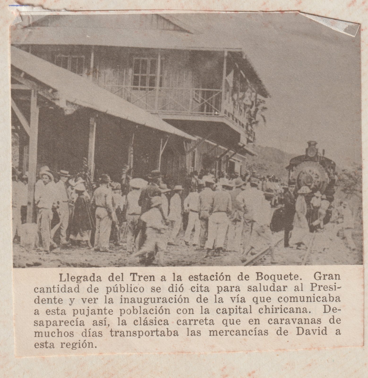
El ramal más largo y emblemático. Subía por Dolega y Caldera hasta la estación «Presidente Porras» en Boquete, atravesando puentes sobre el Cochea y el Majagua. Bajaba el café a Pedregal y subía mercancías y pasajeros a la región cafetalera.
The longest and most emblematic branch. It climbed via Dolega and Caldera to the "Presidente Porras" station in Boquete, crossing bridges over the Cochea and Majagua. It carried coffee down to Pedregal and brought goods and passengers up to the coffee country.
12.067 km · cafetalerocoffee-growing
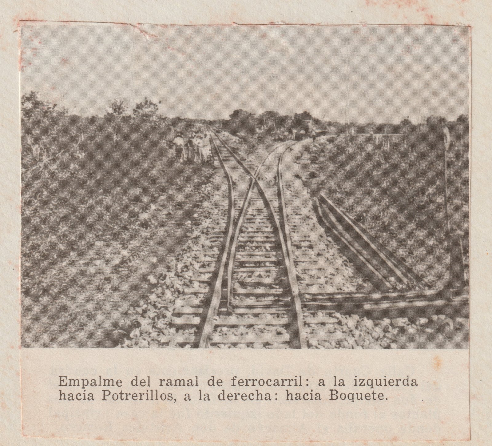
Bifurcación que partía del ramal de Boquete a la altura de Dolega y subía hasta Potrerillos, dando salida a la producción de café y otros cultivos de la zona cafetalera media.
A spur that branched off the Boquete line at Dolega and climbed up to Potrerillos, giving an outlet to coffee and other crops from the mid-altitude coffee region.
6.436 km · enlace con el PacíficoPacific link
El ramal más corto, pero estratégicamente decisivo: conectaba la cabecera provincial con el muelle de Pedregal y, a través de él, con la navegación marítima del Pacífico. Por aquí entraba la mercancía y salía la producción de toda la provincia.
The shortest branch but strategically decisive: it linked the provincial capital with the Pedregal wharf and, through it, with Pacific maritime trade. Imports came in through Pedregal and the province's exports flowed out the same way.